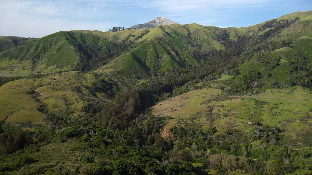
Nestled south of the Monterey Bay Peninsula, the Big Sur area is where the Santa Lucia mountains meet the wild Pacific Ocean, creating some of the most beautiful coastal scenery in the US. We've visited the area more than once and I think the best way to see it is by visiting the state parks along the shores.
But which state park should you choose? And what can you do in each one? We've put together this guide to help you navigate your way along the Big Sur state parks to create the best possible itinerary for your trip.
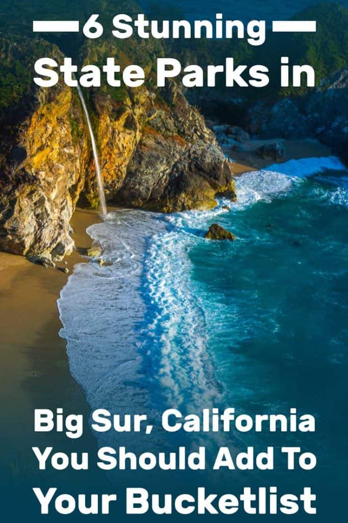
There are six state parks to explore in the Big Sur region. From north to south, they are -
Point Lobos State Park
Garrapata State Park
Point Sur State Historic Park
Andrew Molera State Park
Pfeiffer Big Sur State Park
Julia Pfeiffer Burns State Park
Much further to the south, you'll also find Limekiln State Park but not everyone considers it to be actually located in the Big Sur area, so we decided not to cover it here. Don't worry though, there's plenty to see and do in the other six parks. Join us as we first explore the six parks, and then provide you with more information and tips about visiting the area, including a suggested itinerary.
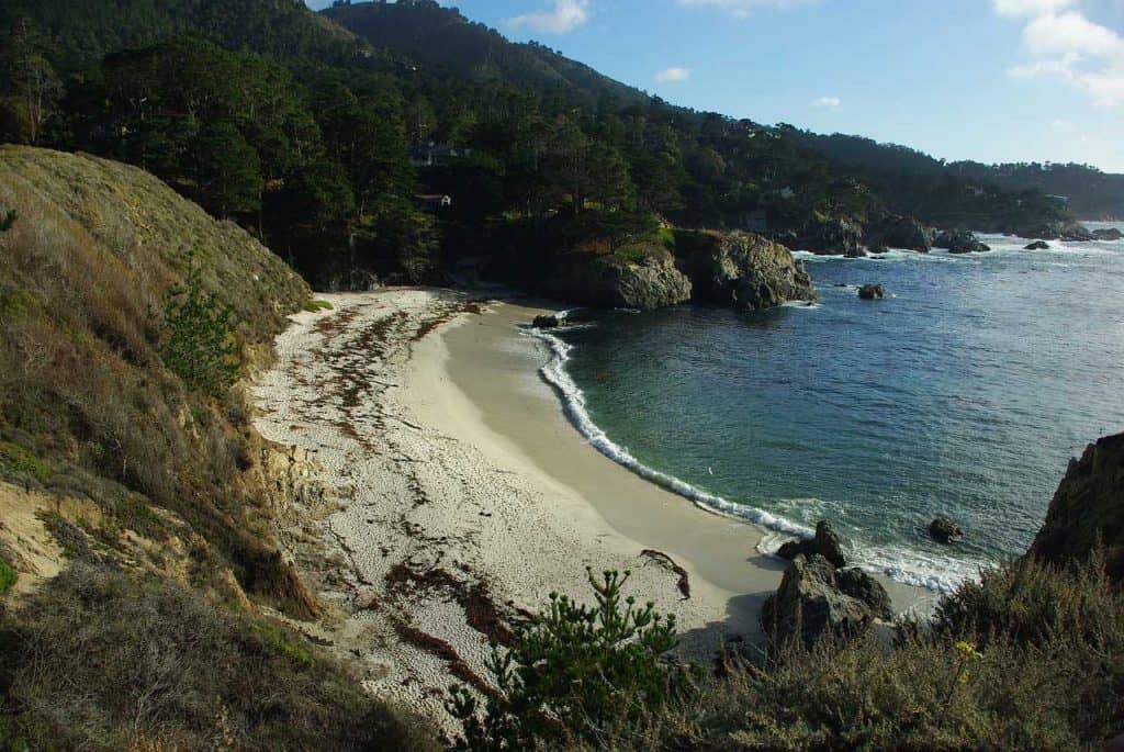
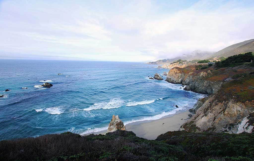
1. Point Lobos State Park
Point Lobos is perhaps the most visited of these parks, largely thanks to its location. This is an easy 15-minute drive from Monterey itself and the park still provide you with magnificent Big Sur scenery.
Point Lobos opens year-round at 8:00 am. Entry into the park lasts until 4:30 pm. All exits must take place by 5:00 pm, including visitors who walk in. Parking is more often available earlier in the day, or late in the afternoon. The park fills up quickly in the morning, so if you want to park inside, consider arriving before 9:30 am or after 3:00 pm.
Vehicles over 20 feet are not allowed during the summer or holidays. Trailers and Motorhomes towing a vehicle are not allowed in the park grounds.
Hiking Trails in Point Lobos State Park
The hiking trails listed below wind through picnic areas and water stations. Don't worry about it feeling crowded. We visited on a Sunday in the summer and while there were definitely a lot of people in the park (we had to wait for a car to leave before they're let us in), it never felt crowded once we began hiking.
Here are some popular hiking trails in this gorgeous park:
Cypress Grove Trail
This trail is 0.8 miles long, looping mainly through Cypress although there are some dramatic coastline views. A guide at the information station will be able to provide insight.
Sand Hill Trail
This trail measures 0.6 miles long and is ADA compliant. It travels in a loop around Sand Hill and intersects with South Shore trail.
South Shore Trail
The southern end of this trail is at Bird Island Parking Area. In this one mile trail, visitors will be able to access pebbly beaches, although accessibility is not recommended for wheelchairs.
Pine Ridge Trail
Despite its short length of 0.7 miles, it intersects or crosses four trails. Although it doesn't meet ADA compliance, it is generally an easy trail to cover.
Lace Lichen Trail
At half a mile, this trail intersects with Pine Ridge Trail and Mound Meadow Trail. Is generally an easy trail to walk, but would be challenging for wheelchairs due to some roots in the path.
Whalers Knoll Trail Loop
Three trails connect with the loop. Although only a half-mile long, it rises 180 feet in elevation. This trail isn't recommended for those with limited mobility.
North Shore Trail
This trail reaches from Whalers' Cove to the Sea Lion Point parking area. It is 1.4 miles in length, including stairs, roots, and rocky ground.
Granite Point Trail
A sixty-minute trail covering 1.3 miles, it is fully accessible and offers a view at Moss Cove.
Bird Island Trail
Hikers should note that Bird Island Trail to China Cove is closed.
South Plateau Trail
At 0.7 miles, this trail presents hilly, uneven surfaces to the hiker. It is not accessible for wheelchairs and not recommended for strollers.
Mound Meadow Trail
This is an enjoyable 0.3-mile shortcut from the entrance to the south shore.
Carmelo Meadow Trail
This fully accessible trail connects with Granite Point Trail, which is also fully accessible. Carmelo Trail winds through pine woods before reaching Granite Point Trail.
For More Information about hiking in Point Lobos and a map of the trails listed above, see this page.
Garrapata State Park is located on Highway 1, 6.7 miles south of Rio Road in Carmel, only three miles south of Point Lobos. This is yet another gorgeous combination of cliffs and beaches, as the mountains meet the ocean. Overall, this park is more rugged and less pampered than Point Lobos, with fewer maintained trails. There are a couple of accessible beaches though and there is no fee to visit Garrapata beach.
Speaking of beaches, while dogs aren't allowed on state park trails, Garrapata Beach is dog-friendly though dogs must be kept on a leash at all times on the beach.
Highway 1 runs through this park as well. At the time of writing this post (early 2019), only trails west of the highway are open to visitors. Check this page for current alerts for all Big Sur state parks. This would be the Soberanes point trail system which is fairly small and good only for a short hike.
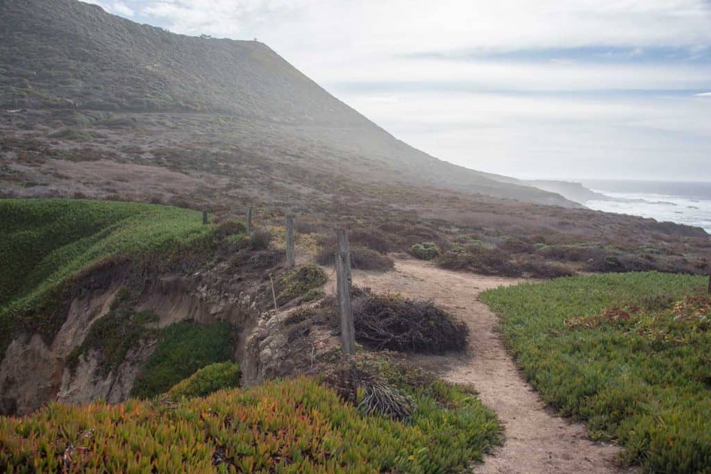
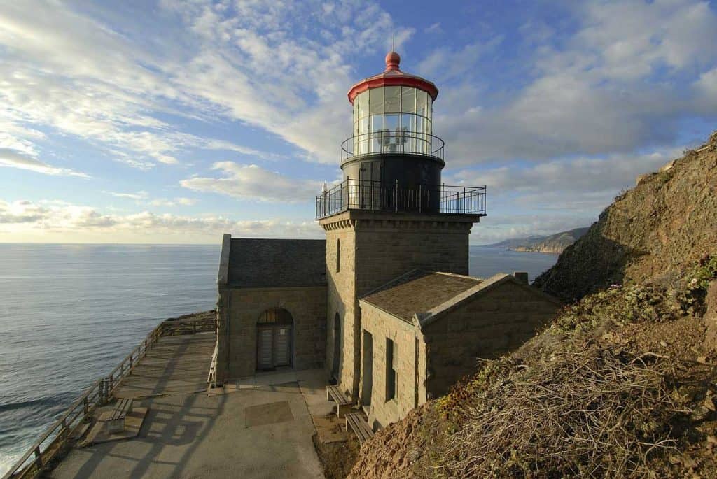
3. Point Sur State Historic Park
Located 19 miles south of Carmel, the main attraction in this state park, located approx. 16 miles south of Carmel is its historic lighthouse. The website states that due to bridge repairs, all tours of the Point Sur Lighthouse are canceled. However, visitors on TripAdvisor gave reviews of visiting the lighthouse and park. Call ahead to confirm the lighthouse is open.
Check out their website for more on Point Sur Historic State Park
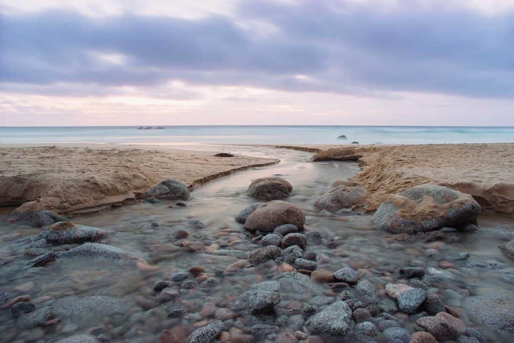
The next park as you drive south along Highway 1, is the Andrew Molera State Park. By now you're only twenty miles south of Carmel on the road. This park used to be private property but the owner - Andrew Molera - donated the land to be a state park, so the wilderness of the area can be preserved.
You can actually visit Andrew Molera's house - now a small museum in the park that's operated by volunteers. It's usually open on weekends between 11am-3pm when a docent is available to show the place.
There's a variety of hiking trails in this park. As always check the park's website to find out about closures. Here's a quick overview of some of the hiking options.
Beach Hiking
Visitors may hike two miles one way from the mouth of the Big Sur River to Cooper's Point. Most of the beach is accessible only during low tide. Be sure to check the tide tables to avoid being trapped or washed out to sea.
Bluffs Trail
This trail traverses 1.7 miles one way. Hikers only may use this trail. Described as easy, the beach below is visible but is not accessible until you reach the 1.7-mile point to intersecting Spring Trail.
Bobcat Trail and Coyote Flat Trail
Travel for 5.5 miles. Hikers are welcome on both trails, while bikers are permitted on Coyote Flat Trail. Hikers enjoy these trails along the Big Sur River through the Redwoods.
Creamery Meadow Trail
This trail runs 2 miles round trip. Hikers should know that crossing the Big Sur River by foot is necessary between October and mid-June. Park authorities recommend caution when crossing the river. Bikers are welcome.
East Molera Trail
For visitors interested in a longer hike, the East Molera Trail runs five miles through grassland and scrub to a small redwood grove. Access is at an underpass near a white barn. Bikers welcome only to the first switchback.
Panorama Trail
Hikers can enjoy this 1.3-mile one-way trail with its lovely views and the pygmy redwood grove it passes through. Hikers only.
Ridge Trail
Considered a strenuous hike, the trail offers great views as it traverses the ridge at 3.2 miles one way. Hikers and bikers are welcome.
Spring Trail
This one-way, short .1 mile hike accesses the Molera Beach from the Bluffs trail. Hikers only.
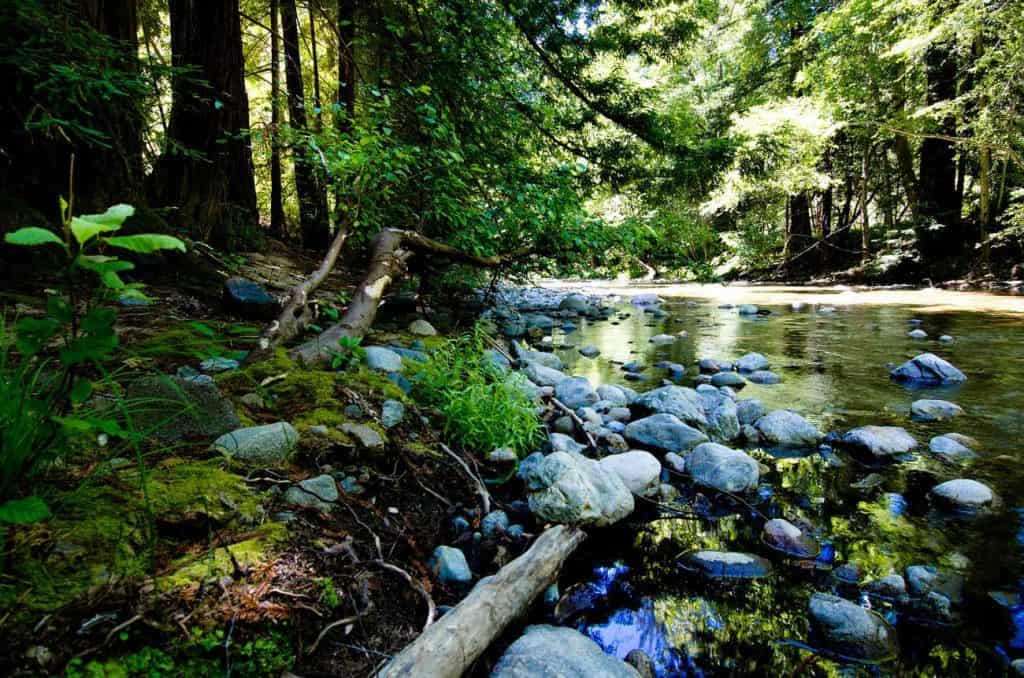
5. Pfeiffer Big Sur State Park
This is the largest and most active state park in the Big Sur area. You'll find lodgings here, as well as a store, visitors center and ranger activities to join. This park is all about the beautiful forest of the Santa Lucia mountains. While there are plenty of ocean viewpoints, there is no actual beach access.
There are wonderful hiking options for all fitness levels. They all give you a chance to enjoy the unique flora and fauna of the Big Sur area. Here's a quick overview of some hiking trails.
Buzzard's Roost
This is a moderate 3-mile long loop trail along the Big Sur River. You'll be through a gorgeous redwoods grove for some great ocean views and the stunning scenery of the Santa Lucia mountains' Sycamore canyon.
The Nature Trail
A short 0.7-mile stroll through the forest where you can learn all about the local flora. A perfect short family hike that's educational as well as fun. Brochures are available at the trailhead and you're asked to return them at the end of your tour.
River Path and Warden's Path
Another short trail and this one isn't just family-friendly it's even accessible to strollers and wheelchairs. Walk along the Redwood Deck in an easy 0.6-mile loop along the bank of the Big Sur river.
Valley View and Pfeiffer Falls Trail
A more challenging trail with some altitude change, this 2-mile long (roundtrip) climbs up in the forest, through oak trees and redwoods. A fork along the way can take you to see Pfeiffer Falls (at the time of writing this post - early 2019 - the trail to the falls is closed).
Big Sur River Gorge
The first part of this trail is a short 0.5-mile paved section. It leads you to the opening of the Big Sur River Gorge. From this point on, you can keep wading through the river to make your way along the gorge. This is quite an adventure - slippery and unstable - so make sure you're fit enough - and come prepared for water hiking.
Mt. Manuel Trail
For fit hikers only, this is not only a long trail (8-mile roundtrip) but also a strenuous one, climbing the mountains for a great view of the area. There's not a lot of shade on the way, so wear a hat and bring lots of water.
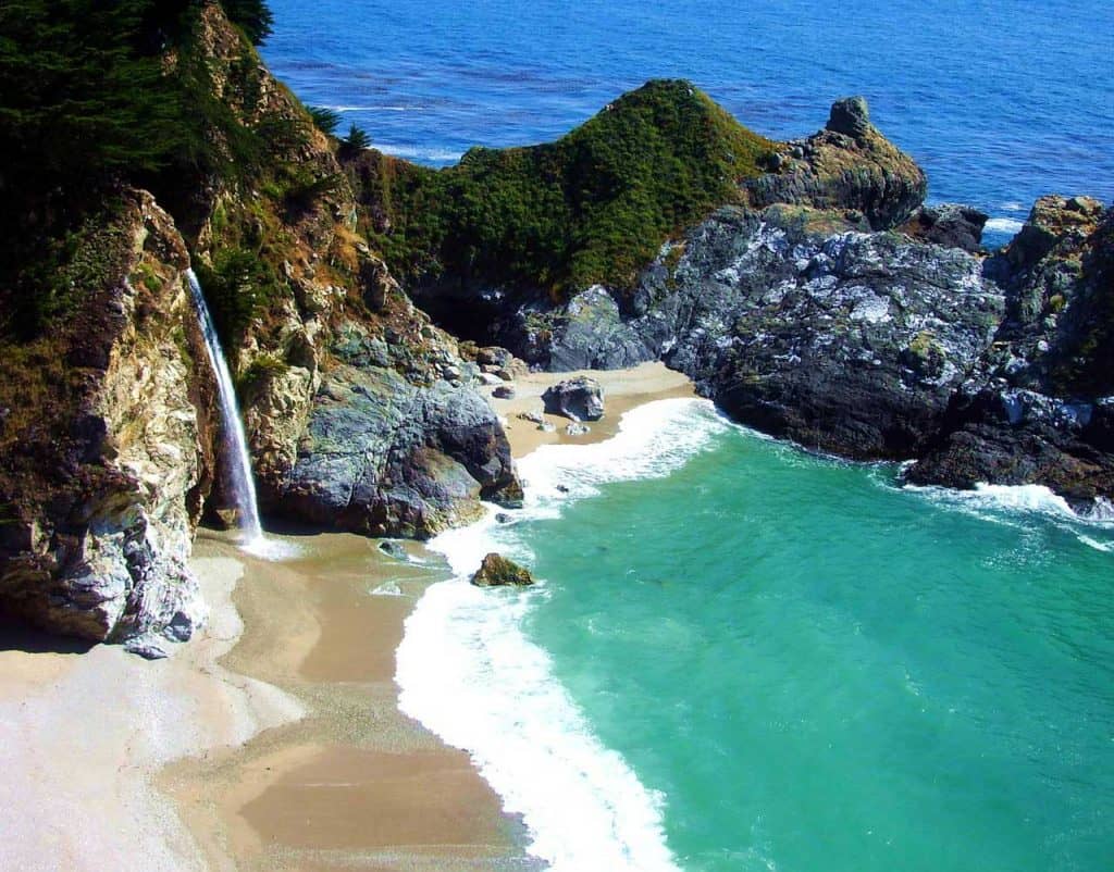
6. Julia Pfeiffer Burns State Park
A similar name but a different park altogether, 12 miles further down Highway 1. This park is most famous for the stunningly beautiful McWay Falls. This famous waterfall drops off a cliff right into the ocean - not something you see every day.
To be fair, the waterfall only hits the ocean water when the tide is in. Otherwise, you're looking at t cute little waterfall that splashes unto the sandy beach cove. Most people see it from the viewpoint near the parking lot so at quite a distance. And no, you can't go down to that beach - that's how everyone gets their shots with no people in them.
This park is also home to great hiking trails that take you through scenic Big Sur landscapes, including Redwood groves. Let's take a quick look at some of them.
Partington Cove Trails
A dirt wagon trail that traverses to the Pacific Ocean, the trail begins at the Partington Cove turnout. Upon reaching Partington Creek, it splits north and south. The trail is one-mile round trip.
Southern Fork of Partington Cove
The southern fork leads through a tunnel to an overlook. Do not go past the bench at the overlook due to the surf being unpredictable and the rocks aren't stable.
Northern Fork of Partington Cove
The northern fork leads to a small, pebbly beach scattered with rocks. The surf is strong and swimming and wading aren't recommended.
Important Tips for Visiting these Big Sur parks
There are a few things you need to know before you come. While this area is securely nestled between San Francisco and Los Angeles, it is not heavily populated and infrastructure isn't what you may expect from the location. These tips are also good for anyone making the drive along Highway 1 between the two cities (which we've done ourselves).
1. Check the state of the road before you head out
Highway 1 is notorious for its infrastructure problems. In fact, the road was blocked in the Big Sur area for more than a year, until the summer of 2018! And it can happen again. The coastline is slowly eroding every winter, so small sections of the road literally fall off into the water from time to time. And fixing that is not an easy feat.
This page gives you an up-to-date list of closed roads and trails in the Big Sur area. Do yourself a huge favor and check it when making your plans and again, before you start your trip.
2. Have your entrance fee ready in cash
These California state parks have an entrance fee of $10.00 per vehicle per day. For a vehicle carrying a senior citizen, the fee is $9.00, while the fee for a vehicle transporting a person with a disabled discount card is $5.00.
The good news is that the ticket you purchase in one of the parks is valid in all others throughout the day. If you're making the drive along Highway 1, you can pay once and stop for 1-2 hours in two or three parks on the same day.
Don't expect them to be able to handle your credit card. Bring cash with you. It's best to have the exact sum though they should be able to handle change from a 20 or even a 100.
3. Plan where you want to stay - and make reservations in advance
There are no towns south of the Monterey Bay area, so if you want to stay close to the parks, you'll find a few lodges and motels that are out there in nature. Which is wonderful, of course, except they tend to be fairly expensive, especially in season.
There are several options for camping as well, either in an RV or tent camping. You can see a list of all campgrounds here. If you want to stay within one of the Big Sur state parks mentioned in this post, your best option would be the Pfeiffer Big Sur State Park. They have a large campground with 190 sites, showers, and even laundry facilities. This dry camping - with no hookups - but it's the best you can find in the area. They do have limitations on RV size, so call ahead to make sure they can take you in (831) 667-2315.
If camping overnight isn't for you, this is an easy day trip from Monterey Bay, so you can find accommodation anywhere in that area. We toured Point Lobos State Park as a day trip from Monterey - a very short drive of under 20 minutes each way.
4. Dress for cold weather - all year around
The coastline of the Pacific can be very cold - even in the middle of summer. Don't expect to get away with a tee-shirt alone - you almost certainly need a jacket as well, even in July and August. Dress in layers so you can take the top layer off as you hike.
5. Be careful when exploring the parks
California has a wild side to it and Big Sur is where you can see it - for good or bad. When exploring the beaches, watch out for the tide, as well as for sneak waves. When hiking, keep young children close by because mountain lions live here too.
Enjoy the trails and the parks, but be mindful of posted warnings and follow their suggestions. They are there for a reason.
Visiting the Big Sur parks: A suggested Itinerary
If you plan on making the drive between San Francisco and Los Angeles on Highway 1, you should allocate at least 2 full days for that. The length of the drive alone is 10-12 hours. That's just driving time. Any stops come in addition to that.
There are many destinations to explore along the route - with the Big Sur parks being only a part of that. With that in mind, I would suggest allocating at least one full day to the Big Sur area, going from the community of Lucia, CA to Monterey.
Alternatively, you can explore the Big Sur area in one or more day trips from Monterey itself. It would take you about an hour to drive from Monterey to the Julia Pfeiffer Burns State Park, from which you can make your way up north stopping at the various state parks mentioned here.
With that in mind, here's a full day's suggested itinerary in Big Sur, going from south to north (feel free to turn this timetable upside down!)
09:00 Arrive at Julia Pfeiffer Burns State Park. Buy your ticket for today and begin by taking in the view of the McWay Falls. If the weather is nice, take half an hour to explore one of the cove trails before driving on.
10:00 Arrive at Pfeiffer Big Sur State Park. Start by going to the visitors center, see if you can participate in a ranger-led activity or just choose one or more of the many hiking trails in the park. You can have your lunch here when you're done, getting food to eat at the store and making use of the picnic area in the park.
13:00 Visit Andrew Molera State Park. Start by visiting the small museum if there's a docent around and then take an hour to explore the beach trails.
14:00 Stop at Point Sur Lighthouse to take some pictures. Check in advance to see if there are any tours and maybe work one into your itinerary.
15:00 Say hi to Garrapta State Park as you pass along Highway 1 and keep driving until you get to Point Lobos State Park. By now, people should be leaving the park so you should be able to find a parking spot. You have 2-3 hours to explore the trails and enjoy the magnificent Big Sur sunset.
And if you have more than one day - you know what to do! Choose one or more of these parks and explore them in more depth! Soak in that special area of the California coastline and take your time to enjoy everything and savour it at a slower pace.
That's it! If you've visited any of the Big Sur parks, leave us a comment with your own recommendations. Oh, and if you can share this post, that would be awesome too - thank you!
 But which state park should you choose? And what can you do in each one? We've put together this guide to help you navigate your way along the Big Sur state parks to create the best possible itinerary for your trip.